| RIDE
ACROSS ILLINOIS (RAIL) NORTH
Route
 Click
Here for the overall general RAIL North
route between Moline and Chicago including the rest
stop locations and mid-route Metra Train Stations overlaid
on satellite imagery. Click
Here for the overall general RAIL North
route between Moline and Chicago including the rest
stop locations and mid-route Metra Train Stations overlaid
on satellite imagery.
Route Description
The RAIL North route almost entirely follows
bike paths, county back roads, and low travelled
residential streets.
We
strongly recommend slightly riding faster at the beginning
of the ride in order to bank time and account
for the expected
slower riding pace coming into Chicago due to increased
traffic and stop lights and stop signs.
From Moline, North Along the Mississippi River
The route begins by following the fully paved and signed Great
River Trail immediately out of the supported hotel in
Moline, riding right along the Mississippi
river
for almost
15 miles. The trail passes directly
behind the
John
Deere
harvester
plant
in East Moline and primarily consists of a dedicated
bike path following residential streets in a few places.
The
first ride of the day could
not be a safer one as the sun comes
up since you will not only be riding on a bike path instead
of busier streets but you will also be riding in a larger
pack due to the group start.
- Click Here for more information about the Moline supported
hotel.
East Across Northern Illinois and Entering Chicagoland
After the route heads east from Port Byron, there is
some climbing to come out of the Mississippi River valley.
From
there the topography
really flattens out and the route is generally flat and fast
across
north
central
Illinois,
proceeding
through relatively low populated rich farmland. We follow
fully paved county back roads into rest stop 3 in Hinckley.
We will have a supported lunch stop at the Subway restaurant
in Hinckley, only 0.5 miles after rest
stop 3. Click
Here for more information.
Once the route crosses Illinois Route 47 west of Aurora,
Chicago urban development begins and the route travels
approximately 45 miles through developed urban areas until
the end.
Path and Road Options into Chicago
Approximately nine miles past Illinois Route 47, you
will
have the option of either following the Aurora Branch
and Main Stem of the Illinois
Prairie Path almost all the way to the Chicago city
limits or continuing on a fully paved on road option.
While the Illinois Prairie Path has a crushed limestone
surface
that can be very bumpy, there are plenty of drinking
fountains along it and the path is very easy to follow
because it is well marked and fully signed. Both
the on road and on path options will stop at the same
rest stops in Warrenville and Berkeley and are very close
to each other. In fact
the two route options
cross
over each other in numerous places and because of this
the two options will be printed individually
on
separate
on road map sets to avoid confusion.
Our final rest stop in Berkeley is right after we cross
the Cook County line the Illinois
Prairie Path becomes paved and all participants will
follow this well signed and established path for obvious
safety reasons
due to
the
lack of vehicular
traffic. The surrounding
neighborhood is used to and expects cyclists passing through.
Metra Train Options into downtown Chicago
In case you are unable to finish the ride, you can easily
take a Metra Train back into downtown Chicago. The Wheaton
Metra station is locted directly on the route between rest
stops 4 and 5, and the Berkeley Metra station is a short distance
from rest stop 5. Bicycles are allowed on the train, subject
to restrictions.
- Click Here for more information about Return Metra Train Service.
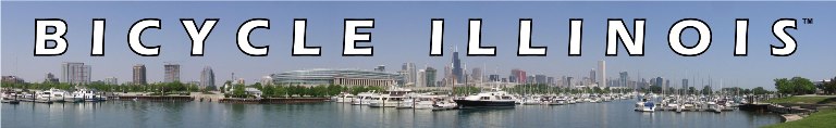
Chicago Ending Location
Our
ending location in Chicago will be at the Diversey Driving
Range in the Lincoln Park
neighborhood. You will only have to ride a quarter mile
under Lake Shore Drive to get to the lake to truly say
you rode across the entire state (the route to the lake
is entirely on paths, not on road). It is also very convenient
to
the brown and
red line CTA
L stops which access all local public transportation options. Click
Here for more information.
The
ending location will not be the supported hotel because there
is no room at the hotel for participants to wait to get picked
up or
for us
to set
up
a rest stop
or park trip vehicles. If you are staying at the Chicago
hotel after the end of the event you will need to bike over
there after you arrive at the ending location.
 Click
on one of the links at left for additional information about
the RAIL North route. Click
on one of the links at left for additional information about
the RAIL North route.
|